


190628Malin Head

pffrench
User
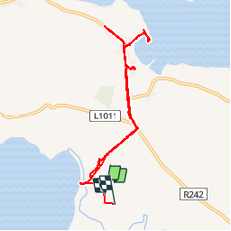

Length
7.3 km

Max alt
23 m

Uphill gradient
52 m
Km-Effort
8 km

Min alt
0 m

Downhill gradient
50 m
Boucle
Yes
Creation date :
2019-06-28 17:53:39.186
Updated on :
2019-06-28 21:09:45.353
3h15
Difficulty : Very easy

FREE GPS app for hiking
 SityTrail
IGN / Geographical institutes
SityTrail Plus
The world is yours!
About
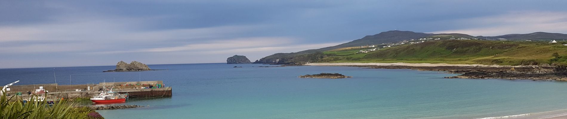
Trail Walking of 7.3 km to be discovered at Unknown, County Donegal, Inishowen Municipal District. This trail is proposed by pffrench.
Photos


Positioning
Country:
Ireland
Region :
Unknown
Department/Province :
County Donegal
Municipality :
Inishowen Municipal District
Location:
Ardmalin Electoral Division
Start:(Dec)
Start:(UTM)
605071 ; 6135530 (29U) N.
Comments